
Google Maps meets Zonedge: The perfect marriage of the familiar and the specialized
You know what happens when you try to juggle ten open tabs in your browser? We always end up losing the one we're looking for, and we spend half our time clicking around instead of doing real work. That's what used to happen to our customers, who had to constantly switch between Google Maps and Zonedge to get their work done.
Well, no more. We've just integrated Google Maps directly into Zonedge, and let me tell you, it changes the game completely.
The best of both worlds in a single environment
Think about it for a second. Everyone knows Google Maps. Your mother uses it to find the best restaurant in town, your brother-in-law uses it to plan his camping trips, and your technical team has already opened it on another screen to check addresses or look at the terrain before heading out. It's become a reflex, like checking the weather before going out.
Now imagine having that power built right into your main work tool. No more juggling windows, copying and pasting addresses back and forth, or losing track of what you were doing. It's all there, in one place, working together like a well-oiled team.
It's a bit like cooking a nice dinner. Before, you had to take pots, utensils, and ingredients out of the kitchen. Now, it's as if everything is already laid out on the counter, ready to be used. It doesn't change what you're going to cook, but it makes the process so much smoother that you can concentrate on what's important: making good food!
Street View: Your eyes on the ground, without leaving your desk
Raise your hand if this has ever happened to you: you're planning a project, everything looks great on paper, then when your team arrives on site, surprise! There's a fence blocking a post that wasn't marked on the plans, or the terrain is completely different from what you thought it would be.
With Street View integrated into Zonedge, it's like having a time and space travel machine. You click on a point in your network, and boom, there you are, on the street, looking at exactly what's ahead. You see poles, buildings, potential obstacles, all without having to set foot outside.
It's not just handy for planning. When a technician calls you because he can't find exactly where he needs to go, you can watch with him in real time. "See that red building on your left? It's just beyond." No need to send him ten text messages or explain for fifteen minutes. You see the same thing he does, and you can guide him like a human GPS.
And frankly, it's a real time-saver. A five-minute virtual tour can save you an unnecessary trip or an unpleasant surprise that could have delayed your entire project by a day. In our business, time is money, and every minute you save is money well spent.
Address search: No more guesswork
How many times have you received a service request with an address that doesn't even exist in your system? Or a potential customer who gives you a vague description like "it's next door to the old Tremblay garage, you know, the one that closed ten years ago"?
With Google's integrated search, you type in anything: a street address, the name of a business, even just "St. Joseph's elementary school", and Zonedge takes you straight there. No more guesswork or searching for three different systems.
This is particularly useful when you're prospecting for new customers. Someone calls you to find out if you serve their area? In two seconds, you can look up their address, see exactly where they are in relation to your network, and give them a clear answer straight away. No "I'll check and get back to you", just fast, efficient service that impresses.
And for your deployment projects, it's even more powerful. Got a list of 50 addresses to connect? You search for them one by one, mark them on your map, then plan your route in the most logical way. It's like having a personal assistant who knows every street by heart.
Satellite view: See what's hiding under the trees
You've heard the expression "the big picture"? Well, with the high-resolution Google satellite map integrated into Zonedge, that's exactly what you get: an overview of your playground, but in ultra HD.
It's amazing how you can see things from above that you don't even notice when you're there. Trails that cut through a lot, dense wooded areas where it's going to be hell to run cable, parking lots where you could set up temporary infrastructure during construction. It all jumps out at you when you look down.
I had a customer tell me the other day how he'd saved a whole day's work just by looking at the satellite view before setting off. He had seen that there was a small access road at the back of the building he had to service, allowing him to avoid going through the main street where he would have had to close off a lane of traffic. A simple observation that changed his entire plan of attack.
And for rural or remote areas, it's downright indispensable. When you need to plan a deployment in an area with which none of your team is familiar, the satellite view becomes your best friend. You can survey the terrain, locate access points, identify difficult areas - all before you even set foot in your pick-up truck.
Familiarity: No need for additional training
You know the best thing about Google Maps? Everyone already knows how it works. Nobody needs an instruction manual to zoom in, zoom out, search for an address or switch to satellite mode. It's intuitive because it's part of our daily routine.
When you integrate features that your teams already use in their personal lives, there's no learning curve. The new trainee who arrives on Monday morning? He'll be comfortable with this part of the tool from the very first minute. Your technician who's not super comfortable with technology? He already knows Google Maps like the back of his hand.
This is a big advantage that is often underestimated. Training a team on a new tool is expensive in terms of time and energy. But when part of the tool is already familiar, it reduces resistance to change. People are less nervous about trying something new when they recognize familiar elements.
It's like learning to drive a new car. If the basic controls are in the same place as in your old car, you'll be comfortable way faster. Same principle here.
Google performance: as reliable as your grandfather's clock
There's a reason why Google Maps has become the global benchmark: it works. All the time. Everywhere. Whether you're in downtown Montreal or in the backwoods of Abitibi, the data is there, up to date, and the service responds at lightning speed.
By integrating Google web services into Zonedge, we give you access to a proven infrastructure. Thousands of servers across the globe, data that's constantly updated, availability that's close to 100%. It wasn't us who invented this; it was Google who put billions into building the world's most reliable system.
And let's face it, in our business, reliability is non-negotiable. When a customer calls with a service problem, you can't afford to wait until your tool decides to work. You need information now, not in five minutes. With integrated Google services, you have that performance guarantee.
It's like having a new service truck with a guaranteed engine. You know that when you turn the key, it's going to go. No nasty surprises, no time wasted troubleshooting technical problems. You concentrate on your work, and the tool follows.
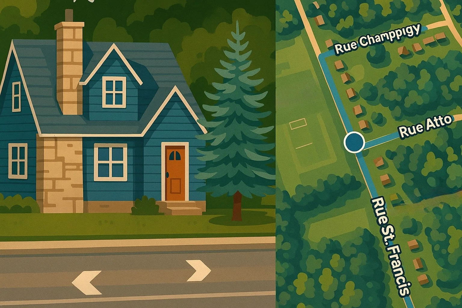
Zonedge + Google Maps: When the familiar meets the specialized
But remember, we're not just talking about putting Google Maps in a window next to your Zonedge tools. No, no, no. We're talking about a truly intelligent integration that makes both systems work together.
Imagine: you click on a point on your fiber network in Zonedge, and instantly, Google Maps shows you exactly where it is, in Street View or satellite, depending on what you need. You search for an address in Google, and Zonedge automatically shows you all the equipment you have in that area. It's not just two tools coexisting, it's two tools talking to each other and helping each other out.
Think of it as a duo of musicians jamming together. Google Maps brings world-class cartography, a gigantic database, and universal familiarity. Zonedge brings its expertise in fiber optics, its ultra-precise network management tools, and its in-depth knowledge of your infrastructure.
Together, they create something greater than the sum of their parts. You have the familiarity of Google Maps combined with the analytical power of Zonedge. You can use the tools you already know to search and explore, and at the same time have access to all the specialized data on your fiber network.
Efficiency through common sense
At Zonedge, we've always had a simple philosophy: make your life easier, not more complicated. When we develop new features, we don't just ask "is it technically possible?" Above all, we ask "will it really help our customers in their day-to-day work?"
Integrating Google Maps just made sense. Why force our customers to use two separate systems when we can put everything together? Why force them to change their working habits when we can adapt our solution to their needs?
We want you to use the tools you already love, in an environment that understands the specifics of your industry. We want your new technician to be productive from day one. We want your planning team to be able to work faster, smarter, without friction.
That's the Zonedge approach: take the best of what exists in the world of consumer technology, then marry it with the super-powered tools you need to manage a fiber optic network professionally. No compromises, just the best of both worlds.
Because at the end of the day, your success is our success. When you deploy faster, when you respond better to your customers, when you manage your network more efficiently, it's not just good for you, it's good for the whole industry. And that's exactly the kind of progress we want to continue to make with Zonedge.
So, are you ready to discover how the familiar can become even more powerful? Your fiber optic network is waiting for you, now with integrated Google Maps, directly in Zonedge. Request a demo.